But just where is it? I don't see it on my map!
The mountain in Sinai discussed in yesterday's post is almost impossible to find in a Bible atlas. Here are two images that should help you pinpoint Hashem el Tarif, this possible site of Mount Sinai. (Click either image to greatly enlarge.)

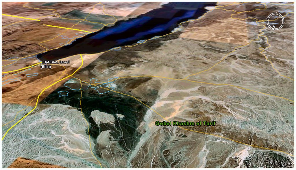
The above image is a satellite view looking south, down into the Sinai peninsula. In the upper left half of the screen you can see the Gulf of 'Aqaba, one of the rabbit ears of the Red Sea, with Eilat at its tip. Hashem el Tarif is marked in the lower middle of the shot.

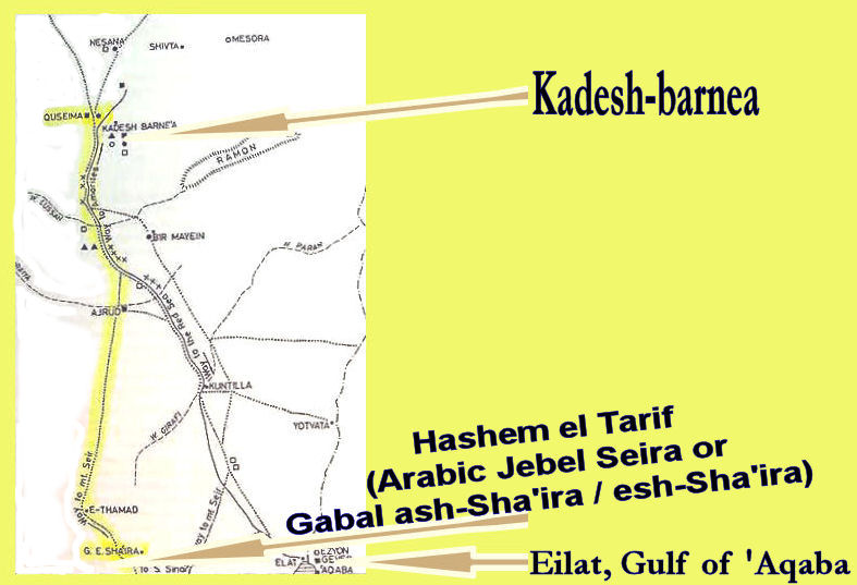
The second image (above) maps out the location of Hashem el Tarif in relation to Eilat and the Gulf (at the lower right corner) and Kadesh-barnea (at the top left). Highlighted in yellow is the proposed "way of Seir," which would distinguish this Seir from the traditional one way over in east Edom.
Note that about midway on this yellow line lies Kuntillet Ajrud (Horvat Teman in Hebrew), a known pilgrimage / cultic stop for northern Israelites (c. 830 and 760 BCE), located 15 km west of the modern Israeli-Egyptian border. You can see that Kuntillet Ajrud also lies near the widely-traveled, strategically important ancient route leading to Eilat (not highlighted but clear on this image).
The above image is a satellite view looking south, down into the Sinai peninsula. In the upper left half of the screen you can see the Gulf of 'Aqaba, one of the rabbit ears of the Red Sea, with Eilat at its tip. Hashem el Tarif is marked in the lower middle of the shot.
The second image (above) maps out the location of Hashem el Tarif in relation to Eilat and the Gulf (at the lower right corner) and Kadesh-barnea (at the top left). Highlighted in yellow is the proposed "way of Seir," which would distinguish this Seir from the traditional one way over in east Edom.
Note that about midway on this yellow line lies Kuntillet Ajrud (Horvat Teman in Hebrew), a known pilgrimage / cultic stop for northern Israelites (c. 830 and 760 BCE), located 15 km west of the modern Israeli-Egyptian border. You can see that Kuntillet Ajrud also lies near the widely-traveled, strategically important ancient route leading to Eilat (not highlighted but clear on this image).
posted by S and C at 5:55 AM
![]()
![]()
1 Comments:
The real Horeb is just north of Qumran. There is an oil (tar) seep there where the burning bush was and many man made features that match the ones at the camp of Moses. There is a book to be published on this site fairly soon. If you wish to reserve a copy email: james.jstoneisrael@gmail.com
Post a Comment
<< Home